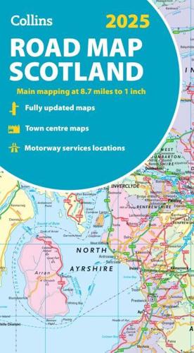
Publisher's Synopsis
Explore Scotland with easy-to-read mapping from Collins.Full-colour map of Scotland at 8.7 miles to 1 inch, with clear road network and administrative areas shown in colour. The map covers the whole of Scotland and part of Northern England conveniently on one side, and is ideal for reference or route planning.The map shows the road network in detail for easy route planning and has easily identifiable local council areas and boundaries.The main features of this road map are:Fully updatedAdministrative areas shown in colourClear, detailed road network and road distancesTown and city names, rivers, railway lines and canals are clearly shown7 city/town centre street plans showing places of interestIndex to place namesMileage chartCar ferry routesKey in English, French and German.